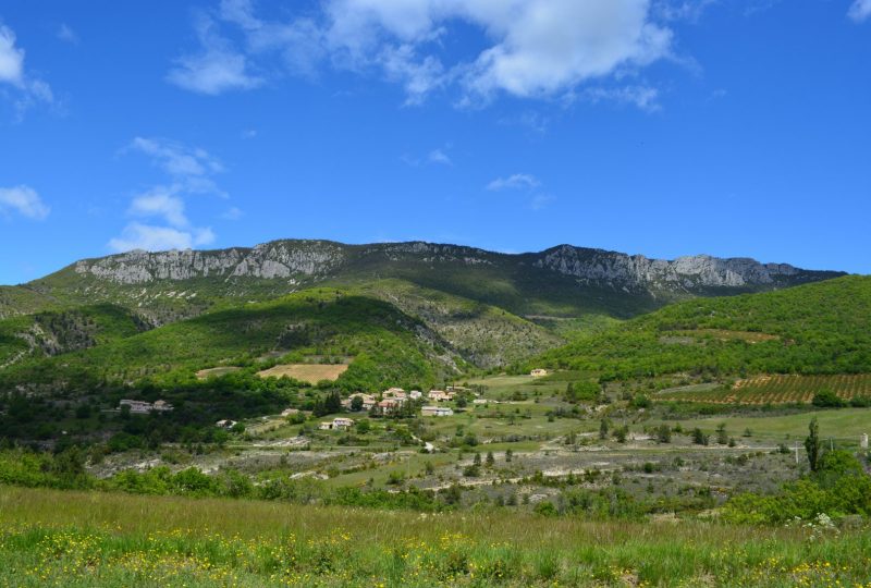
A beautiful, long hike along the ridges of the Grimane (1242m) and Grêle (1276m) mountains, marking a hilly landscape overlooking the Ennuyé valley. Several tributaries of this river have their source in these mountains.
Description
Departure : Park in the village of Saint-Sauveur-Gouvernet, on the pitches between the plane trees.
1. From the village center, at the signpost (Saint-Sauveur, alt. 559m) go straight ahead on rue de l'Église (heading north-west). This then turns left. Just before leaving the village, turn right onto rue Fontaine d'Autran. After 50m, when this ends, take the road to the right and follow the track which rises slightly to the right.
2. 400m further on, you come across a track. Turn left. Always stay on the main track when it crosses secondary tracks (which are private roads).
3. After 400m, stay on the main track which goes left. 100m further on, at the fork in the road, turn left.
4. At the crossroads 100m further on, continue straight ahead. The track becomes a path, still uphill, and enters the undergrowth. After 300m, stay on the right-hand path.
5. Turn left at the fork. You then come to a flat area. The path climbs up to the ridge, with a fine view of the Ventoux.
6. At the crest (alt. 1000m on IGN), turn right. The path climbs through undergrowth heading east, then through beech forest as you approach the crest.
7. At the fork in the road, keep straight ahead on the ridge. You'll reach some grassland. Follow the markers. The path then descends into a beech grove, and continues below the ridge, before climbing again.
8. Descend to a crossroads. This is the Buisson de Derbon pass (alt. 1184m on IGN). Turn right onto the downhill path. Be careful, the descent is steep and straight.
9. After 600m, you come to a track which you take on the right as you descend.
10. At the fork 500m further on, turn left downhill. The track twists and turns, crossing the stream twice, before running alongside it into the Gouvernet ravine.
11. The track becomes a road and bends round. Turn right, staying on the main road. You pass through the hamlet of Gouvernet.
12. Rejoin the D64 at the Gouvernet crossroads (630m). Cross the road, then turn left towards the Teste plain for 200m. Leave the road shortly after the bridge to take a track to the right.
13. After 200m, at the fork in the road (alt. 630m on IGN), turn left. You will then pass by an old house.
14. You reach the Plaine de Teste crossroads (680m). Turn right onto the track leading down to Saint Sauveur - Bésignan. This then becomes a tarmac road.
15. 2 km further on, you come to a crossroads. Take the road to the right. Cross the bridge over the Ennuyé river.
16. Join the D64, which you follow to the right for 50 m, before turning left onto the road that climbs, and after 100 m, at the fork in the road, take the road to the right. You'll find Saint-Sauveur again, follow the road to the left and return to the start parking lot.
Spoken languages
- French
Labels and ranking
- Open air
Activities
- Pedestrian sports
- Hiking itinerary
Visit
Individual tour
- Average Duration of the individual tour: 360 minutes
Rate
Situation
To see the spot on the map, you can fly over the altitude difference below.

