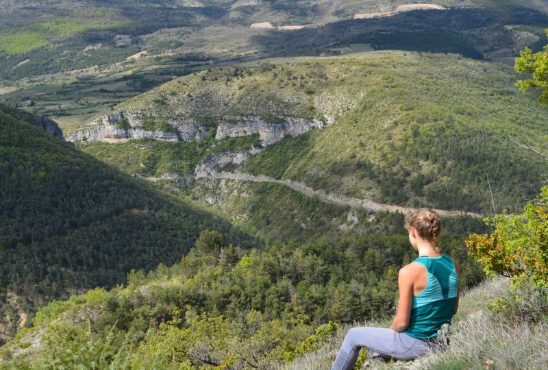
A lovely walk taking in Saint-Auban-sur-l'Ouvèze, whose history has been marked by strong Protestantism, and discovering the Serre Rioms crest and its lovely viewpoint over the Charruis gorges.
Description
The village was once a tollbooth controlling several important routes: the Buis-Orpierre, Rosans-Séderon and Buis-Séderon roads. Saint-Auban is the birthplace of the "Clos d'Aguzon" brand of cosmetics and interior decoration products, in the complex of buildings of the same name. Originally a family-run herbalist business, Clos d'Aguzon has extended its age-old expertise to the perfume industry and fragrance gifts. Saint-Auban-sur-l'Ouvèze also boasts a chestnut grove planted in the Middle Ages. At the beginning of the 20th century, the largest of these trees was 3.2m in diameter and estimated to be nine centuries old. But it was accidentally burnt down in 1911. The Serre de Rioms ridge takes its name from an ancient perched village dating from the 19th century, of which only one house remains today, on the Villevieille ridge. From this ridge, there's a lovely view of the Charruis gorges.
Departure point: At the entrance to the village of Saint-Auban-sur-l'Ouvèze from Vercoiran, park in the large parking lot on the right-hand side of the road.
1. At the far end of the parking lot, head for the old wash-house. Follow a small path to the left of the washhouse. You reach the main road, which you cross before passing under the porch and taking the stairs. Continue right along the main road for 20m, then turn left. You pass under a porch and come out onto Rue des Consuls. Follow this to the left, which becomes Rue d'Albert de Rions. Turn right onto rue du Dragon (uphill). You arrive at Place Montferrane. Turn left onto rue du Château.
2. You arrive at Place Péquin (650m). Take the chemin de la cime des Blaches. After 50m, the road becomes an unsurfaced track, slightly uphill.
3. Leave the track and take a path to the right, which follows the ridge for 1.6km. You pass an abandoned wooden cabin, then the orientation table (820m).
4. At the fork, leave the ridge and take the left-hand path through the undergrowth. After a few metres, the descent becomes steep, with a few bends. Before leaving the ridge, you can return to the summit of Serre de Rioms, 100m further on.
5. You come out in front of a lavender field, respecting the crops. Turn left to walk along the top of the field, then down the left-hand edge.
6. You come to a flat track which you take on the left for 1.9km. You pass the cemetery and low walls.
7. Back in the village, at Place Péquin go straight on to Rue du Château (GR91 signposts). From here, you can choose to return to the parking lot by the same route you took on the outward journey, or opt for a return route that allows you to visit the village for sightseeing.
Variant return from Place Péquin, for a sightseeing tour of the village (400m instead of 200m to the parking lot, 0m D+):
Do not turn right as on the outward journey (rue des Dragons), but continue straight ahead. Pass to the right of the church (rue des Anciens Soustes). Then go straight on and descend to the right, passing under a porch. Turn left onto rue du Temple. Go down a few steps. Cross the main road, then turn right for 10m, and take rue de l'allée Armand opposite. This is an underground cobbled alley. After the porch, turn right. You'll pass another porch, then an alley leads back to the main road. Follow it for a few metres, then turn left down the stairs you used on the outward journey. Follow the same route to the parking lot.
Spoken languages
- French
Labels and ranking
- Open air
Activities
- Pedestrian sports
- Hiking itinerary
Visit
Individual tour
- Average Duration of the individual tour: 120 minutes
Rate
Situation
To see the spot on the map, you can fly over the altitude difference below.

