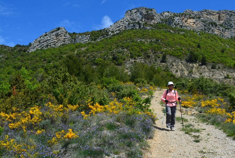
This hike to the characteristic summit offers panoramic views over the Beauvoisin valley and Mont Ventoux.
Description
Nearby is the Grotte du Maquis, the first FTPF maquis camp created on March 12, 1943. Eight young Resistance fighters spent a few days there in late winter 1943. But living conditions there were difficult, and following an attack, the group had to migrate further north, to the foot of the Linceuil mountain, renovating an old sheepfold that would later bear the name of La Fournache, near which we also pass on this hike. Nearly 50 refractory members lived there for 4 months, before being denounced and the farm taken over by Italian troops in August 1943.
Departure: From the hamlet of Les Jonchiers, follow the D523 to Beauvoisin.
At the entrance to the village, park in the parking lot on the left.
1. On leaving Beauvoisin, follow the D523 towards Les Jonchiers. Pass through farmland.
2. After 200m, turn left onto Chemin de la Croix.
3. At the fork below the houses, turn right onto chemin de la Bastie. This bypasses the hamlet. Continue along the main road to the right. Just beyond, there's a lovely view of Mont Ventoux.
4. At the next crossroads, take a small tarmac road which climbs to the left. After 20 m, this becomes a track.
5. After 300m, turn right, staying on the track. The track is flat, just at the foot of a steeper area.
6. At the fork, leave the track and turn left onto the path.
7. As you approach the pass, the path enters a rocky area. Two promontories offer panoramic views of Mont Ventoux and Beauvoisin. A wooden sign indicates the Col de la Posterle (895m). Take the right-hand track into the forest.
8. You come to a track which you take to the right, following the GR9 markers. 50m further on, you come to the Col de Linceuil (893m). Here you'll find an old sheepfold (La Fournache). Continue straight ahead on the track
towards the Col de Milmandre.
9. At Col de Milmandre (852m), turn right onto the track towards Beauvoisin. Shortly afterwards, there's a view of the Baume Noire climbing site on the left.
10. Follow the track as it curves to the left. You pass the foot of the climbing site, then the parking lot.
11. At the fork in the road, take the left-hand track, which becomes a tarmac road.
12. 200m further on, at the fork in the road, turn right up the hill. This is the chemin de la Bastie aux Brunots. Follow it for 1.2 km.
13. After a short climb, you come to a road which you take on the right in the direction of the climb. 50 m further on, you come to the crossroads from the outward journey. Stay on the main road to the left.
Follow the same route to the parking lot.
Spoken languages
- French
Labels and ranking
- Open air
Activities
- Pedestrian sports
- Hiking itinerary
Visit
Individual tour
- Average Duration of the individual tour: 240 minutes
Rate
Situation
To see the spot on the map, you can fly over the altitude difference below.

