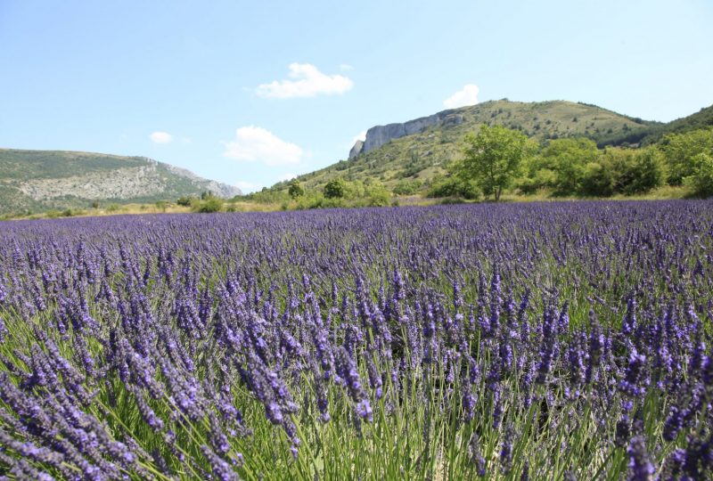
A hike on one of the region's most emblematic and unmissable sites. Montagne du Fort offers an exceptional panorama from the very site of the ancient fortifications, cradle of the founding lords of the Baronnies.
Description
Mévouillon, historic cradle of the Baronnies Provençales. From the 11th to the 14th century, the lords of Mévouillon ruled the surrounding valleys from the top of the rocky plateau known as "Le Fort de Mévouillon": a so-called impregnable castle built at the southern end of this natural fortress. Representing a danger in the eyes of the king, the fort was razed to the ground in 1684. The all-powerful Barons nevertheless left their name to the Baronnies. At the top of the plateau, there's not the slightest trace of a castle, just the vestige of a pond that has stood the test of time...and a magnificent view over the Baronnies.
Departure point: Mévouillon, "Gresse, alt.820 m" Car park at the eastern entrance to the hamlet of Gresse.
1. Opposite the parking lot below the village, cross the main road to take a path and a small footbridge over the stream. Further on, the track splits.
2. Go up to the left, then left again on the narrow path which leads to a track. Follow it to the left, join and cross the D 546. Follow the track up to the Barbantane church.
3. Behind the building, follow the track to the right. A few metres further on, before reaching a lavender field, turn left up the hillside.
mountainside. Climb the ridge to the bottom of the cliffs. Turn left and find a path leading up to the plateau.
4. Retrace your steps and start the descent, heading south. At the foot of the cliffs, go around the rock and shortly afterwards turn right onto a
join an attractive track. At the bottom, turn right onto the tarmac and continue slightly right to the hamlet of Col.
5. Turn left onto a track which becomes a small road and joins the main road. Cross it and take the track opposite. Ignore the
the left-hand track, pass the Chanaux farm and follow the wide track which rises gently into the valley below the Buc mountain. Reach the "Mourès, alt. 960 m" crossroads.
6. Leave the main track and turn right towards "Gresse". Drive alongside a cross-country course. Go around the hill, turning right again at the next junction. Follow the track for 700 m, watching for a path on the left.
7. Turn right at the shed, go along an oak grove for about 150 m, turn right on the path over the ravine (signposted "chapelle"), then left (cairns).
then turn left (cairns): the itinerary climbs for about 30 m, through a rocky clearing, to rejoin the signposted path. The chapel is located on the rocky peak above you: the climb begins.
8. Take the track completely to the right which leads back to point 2. Rejoin the hamlet of Gresse by the same route as before.
Spoken languages
- French
Labels and ranking
- Open air
Activities
- Pedestrian sports
- Hiking itinerary
Visit
Individual tour
- Average Duration of the individual tour: 170 minutes
Rate
Situation
To see the spot on the map, you can fly over the altitude difference below.

