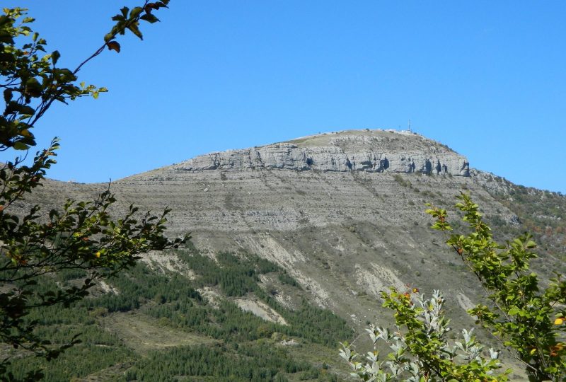
The shady climb up the Rieu valley means that this hike can be enjoyed even in hot weather. The view of the Baronnies countryside from the summit grasslands is breathtaking.
Description
In addition to its breathtaking views, the Bergiès summit is home to CosmoDrôme: an observatory with a pure, light pollution-free sky. The site is open to the public and hosts regular sky-discovery events. Two domes house powerful telescopes, and a projection room and documentation room are available for those wishing to learn or refine their knowledge of astronomy.
Departure point: " Séderon, alt.795 m " parking place de l'église
1. Take the D542 towards Lachau. After 230 m, cross the small bridge to the left and continue along the Route du Rieu, following the main road which gives way to an unsurfaced track.
2. At the "Le Rieu" crossroads, alt.820 m, turn left, taking the track that runs under the farm and deep into the valley. At the end of the cultivated fields, let go of the first two tracks which go up to the right, to reach another fork 20m further on.
3. Leave the main track and take the path slightly to the left. Follow the stream, then cross it on a path to the left, which rises through the woods and crosses the stream several times. Climb the steep slope of the thalweg, then when you reach a flat spot (car body), leave the small path on the left which climbs upwards and continue along the wide track until you reach the "Font de Buc, alt. 1000 m" crossroads.
4. Take the left-hand path through the woods, then the path that crosses and runs alongside the combe (follow the signs).
5. At the end of the woods, "Serrière de Piberos, alt. 1190 m", follow the ridge and cross the grassy knoll (pastoral area, stay away from herds). At the Petit Col (alt.1157 m), descend to the right into the valley, leaving the right-hand path leading to Barret-de-Lioure and climb back up to reach the road at Col de Lombard (alt.1187 m).
6. Turn left along the road for 900 m, and when you reach the Séderon basin, leave the road and climb the ridge path to the Bergiès summit (alt.1367 m).
7. Take the same path back down to Col de Lombard.
8. Follow the road for 1.2 km to Croix de Bais (alt.1124 m).
9. Just before the cross, take a path to the left. This descends into the woods and gradually becomes a path. As you leave the woods, follow a field and cross the stream to reach a small road.
10. Follow it downhill on the right for 700 m to reach the D542. Turn left, enter the village and descend towards the church.
Spoken languages
- French
Labels and ranking
- Open air
Activities
- Pedestrian sports
- Hiking itinerary
Visit
Individual tour
- Average Duration of the individual tour: 325 minutes
Rate
Situation
To see the spot on the map, you can fly over the altitude difference below.

