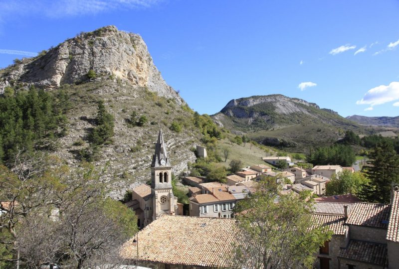
This short hike loops around the warm hills of Séderon, with views over the upper Méouge basin to the Mévouillon fort.
Description
In the past, Séderon was a small trading town, drawing in the surrounding population via the mountain pass where it nestled. Later, the settlement expanded to the south and east, to take advantage of the sunshine. Its altitude of 800m makes it an ideal place to recharge your batteries. The village is crossed by the Méouge river, which rises just upstream. It is dominated by the Rocher de la Tour, a watchtower and relay station in the Middle Ages, of which a few vestiges remain. The orientation table at the top offers a wide view of the surrounding area. The Tower is dotted with thyme. Hyssop can also be found here. The botanical trail presents a sample of local plants and their uses.
Departure point: " Séderon, alt.795 m " parking place de l'église.
1. Go up the rue de la Bourgade, and at the crossroads, continue straight ahead on the chemin de Pale.
2. At "Saint Charles, alt. 810 m", stay on the road, past the cemetery to the "Croix Rouge, alt. 818 m" crossroads.
3. Turn left for 170 m, then left again up the gravel path. After the wooden shed, turn right, then left at the next junction to reach the Grandchane farm.
4. Go around the buildings to the left, enter the park (make sure to close the gates after you've gone through) and then climb the steeply sloping track for 100 m. Follow a cultivated plot to the right. Pass over the quarry on the left and continue up the path on the adret. It leads to the "Crête de Costadret, alt. 950 m".
5. Turn left along the ridge. Descend through lavender and thyme on a somewhat steep slope in the direction of Séderon. Leave the park at the pass.
6. Take the path to the west and climb to the right, towards ND de la Brune. Go around the chapel ruins to the right. Continue straight on through the garrigue to the summit of La Tour (alt. 917 m), where you'll find an orientation table.
7. Turn left and follow a winding path down the grassy slope. At the plateau, turn left.
8. Turn right along the botanical path to "Saint Charles, alt. 810 m". Descend towards the village and reach the parking lot.
VARIATION
Follow the above itinerary to point 2.
2. From "Croix Rouge, alt. 818 m", turn left and follow the botanical trail straight ahead. Walk 350 m to the trail intersection.
8. Continue straight ahead to reach point 6.
6. Then follow the above directions from point 6.
Spoken languages
- French
Labels and ranking
- Open air
Activities
- Pedestrian sports
- Hiking itinerary
Visit
Individual tour
- Average Duration of the individual tour: 120 minutes
Rate
Situation
To see the spot on the map, you can fly over the altitude difference below.

