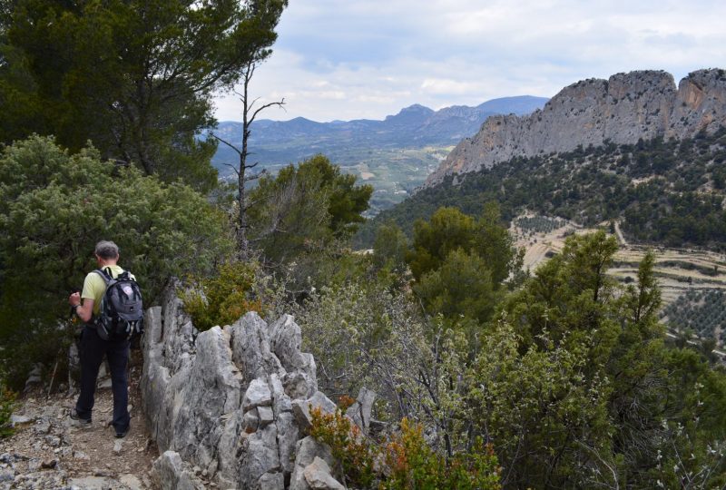
The Saint-Julien rock rises above Buis-les-Baronnies. The path through the garrigue takes us around this rocky blade coveted by climbers.
Description
An emblematic hike in Buis-les-Baronnies, around the Rocher du Saint-Julien, the Pays de Buis' leading climbing spot. The rock is a 120 m-high limestone lace. From 1932 onwards, numerous attempts were made to climb the ridges of Saint-Julien. But the first complete traverse was achieved in 1946. From then on, several routes were opened on this rock, then re-equipped in line with current tastes, to offer large, safe routes. Since 2014, 4 via ferrata have also been equipped. This loop also provides a round trip to the Chapelle Saint-Trophime. Built on a Gallo-Roman
Gallo-Roman cult site before the 16th century, this chapel overlooks the Ouvèze river. The statue was erected in 1872 by a Buxois carpenter, who is said to have carried the olive tree trunk on his back. Trophime, bishop of Arles around 250 and Patron Saint of Buis in the 17th century, cured gout!
Start: Place du Quinconce, center of Buis-les-Baronnies
1. From Place du Quinconce, head south towards the municipal campsite to cross the Ouvèze bridge. Turn left on Chemin de Malgras for 50m. Then turn right onto Avenue Guillaume de Plaisians. The municipal swimming pool is on the right.
2. At the fork in the road, continue straight ahead on the small road which climbs following the signposts. After 50 m, go straight on to the Chemin du Saint-Julien (follow the signs). 100m further on, you come to another fork in the road. Take the stony path straight ahead. You come to a track, the
carrefour du Pin d'Ais (436m).
3. Go to the signpost, 20m to the right as you leave the path. From here, take the track which continues straight ahead at a flat angle. This is the via ferrata parking area. Continue on this track towards Saint-Julien (GR9 markers).
4. After 500m, take the right-hand path. This path leads to the via ferrata departures.
5. At the second bend, you come to a crossroads. On the right is the via ferrata trail. Turn left (markers). You're approaching a wooded area with boulders.
6. You come to a flat area with a cairn (alt. 690m, Pas du Saint-Julien, not marked on IGN). Continue to the left. The path is flat, sometimes slightly uphill, and heads straight east. Halfway along, you'll come to a lovely view of La Roche-sur-le-Buis to your left. The path leads to a place called
Sabouillon (844m).
7. At the Sabouillon crossroads, take the right-hand path.
8. After 200m, at a cairn, turn left. The slope increases steeply, always downhill. This is the Serre Long ridge. The path then joins a rocky section, technical but fun. Halfway up the ridge, you pass two large cairns, and continue straight ahead.
9. At the end of the ridge, turn left at a cairn, then immediately right. At the pass 50 m below, turn right. After a bend, you come to a track which you take to the left.
10. Follow the road to the left and back to the chapelle Saint-Trophime (AR: 900m; 10 m D+; 15 min). From here, there's a fine view of Buis, the Ouvèze valley, Le Buis and Saint Julien.
11. Back at the junction between the track and the road, stay on the downhill road. Cross a small bridge, and after a hairpin bend arrive at the Saint-Julien climbing site parking lot.
12. After 1 km, after passing a lime tree with a bench, turn left onto a hairpin path.
13. You reach the road, which you take downhill on the left to return to Buis-les-Baronnies.
2. Return to the original junction. Follow the same route as on the outward journey to the parking lot.
Spoken languages
- French
Labels and ranking
- Open air
Activities
- Pedestrian sports
- Hiking itinerary
Visit
Individual tour
- Average Duration of the individual tour: 160 minutes
Rate
Situation
To see the spot on the map, you can fly over the altitude difference below.

